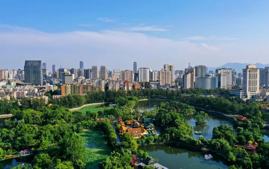
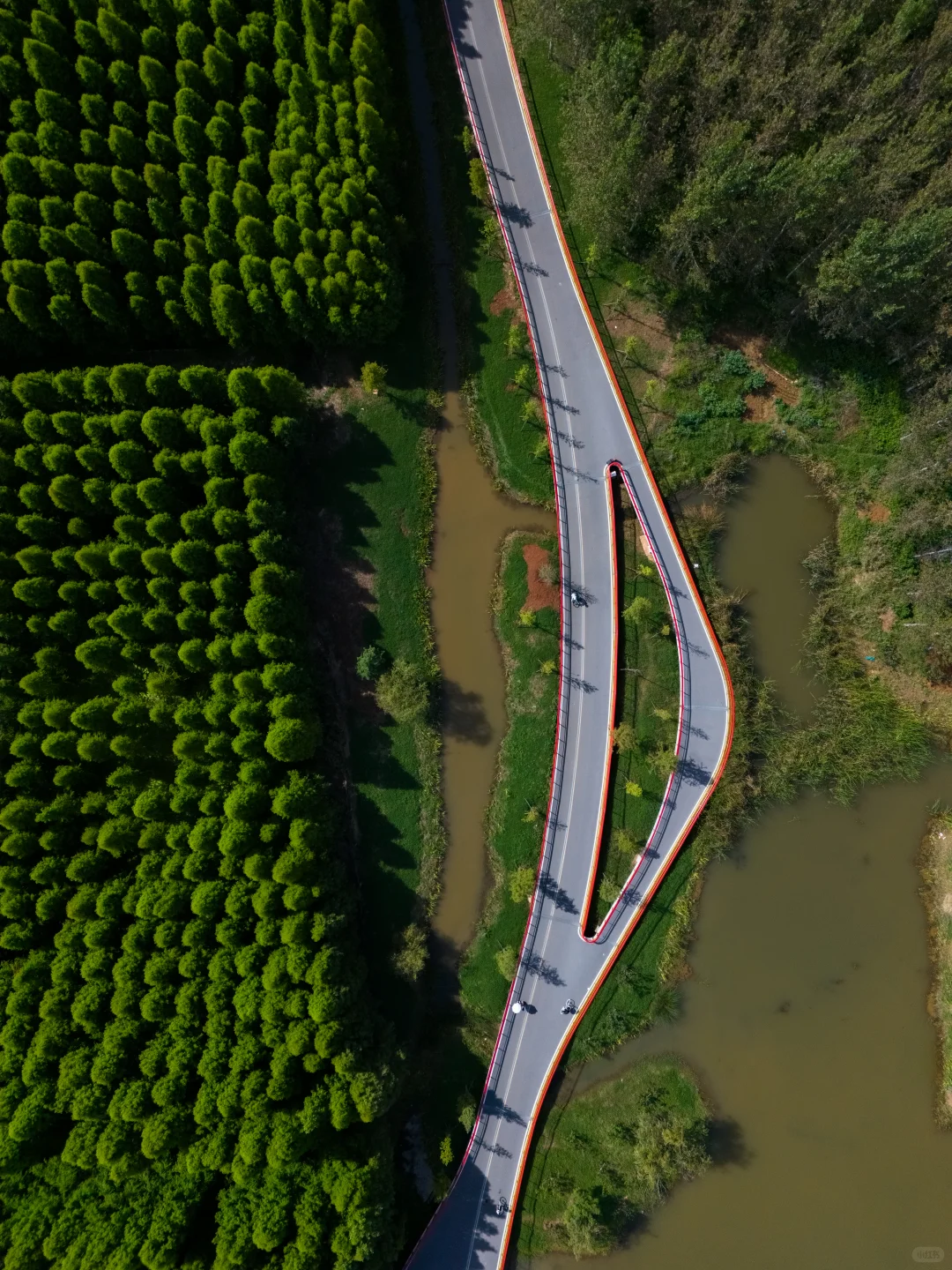
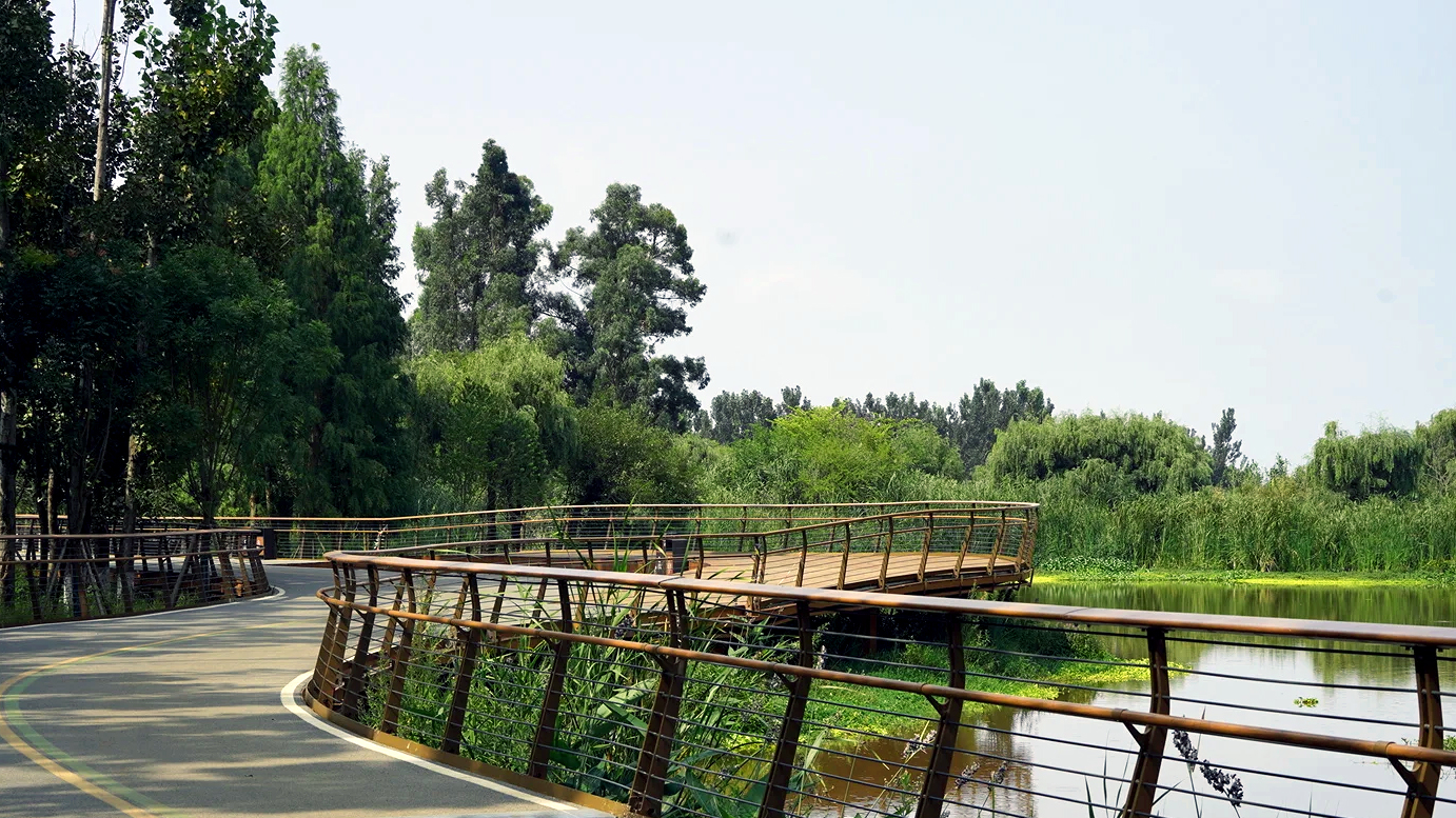
The Dianchi (Lake Dian) lake-loop Greenway is planned for 137km, with 108km now open, across four zones: Caohai, the East Shore, the South Shore, and Jinning. Dedicated red-blue cycling/walking paths link 43 wetlands, 13 boardwalk bridges, and seven themed cloud bridges — the Water Bridge arcs like a rainbow over the river, the Hill Bridge spirals to a viewpoint, the Wood Bridge threads through a metasequoia forest. Motor vehicles are banned throughout, and the whole route is free to enter.
The Basics
The Dianchi Greenway is Kunming's largest lakeside public-space project in recent years — free to enter throughout, with motor vehicles banned.
Open 8:00–19:00 daily; boardwalk bridges and closed sections are cleared at 19:00, so exit the main greenway nearby. Along the route there are 34 public restrooms and 5 official visitor service stations.
Route Map
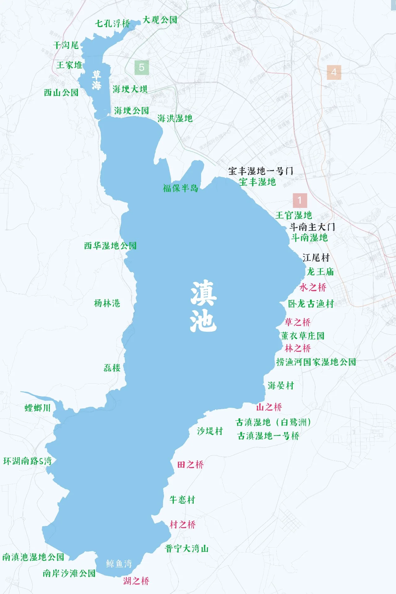
The Dianchi Greenway loops the lake in four zones: the Caohai section on the north shore (leisurely city walk), the East Shore wetland gallery (where the seven bridges cluster), the South Shore sunset scenery (the golden line for chasing the sun), and the Jinning west section (advanced cycling). The map marks every entrance/exit, the seven themed bridges, and the core wetland locations.
The Four Complete Sections
The 108km of open greenway is split into four sections by geography, each offering both walking and cycling. Mix and match by stamina and interest — a half-day stroll or a full lake loop both work.
1 · Caohai Section
23 kmLeisure city walk, beginners' first pick · flat throughout, no steep slopes
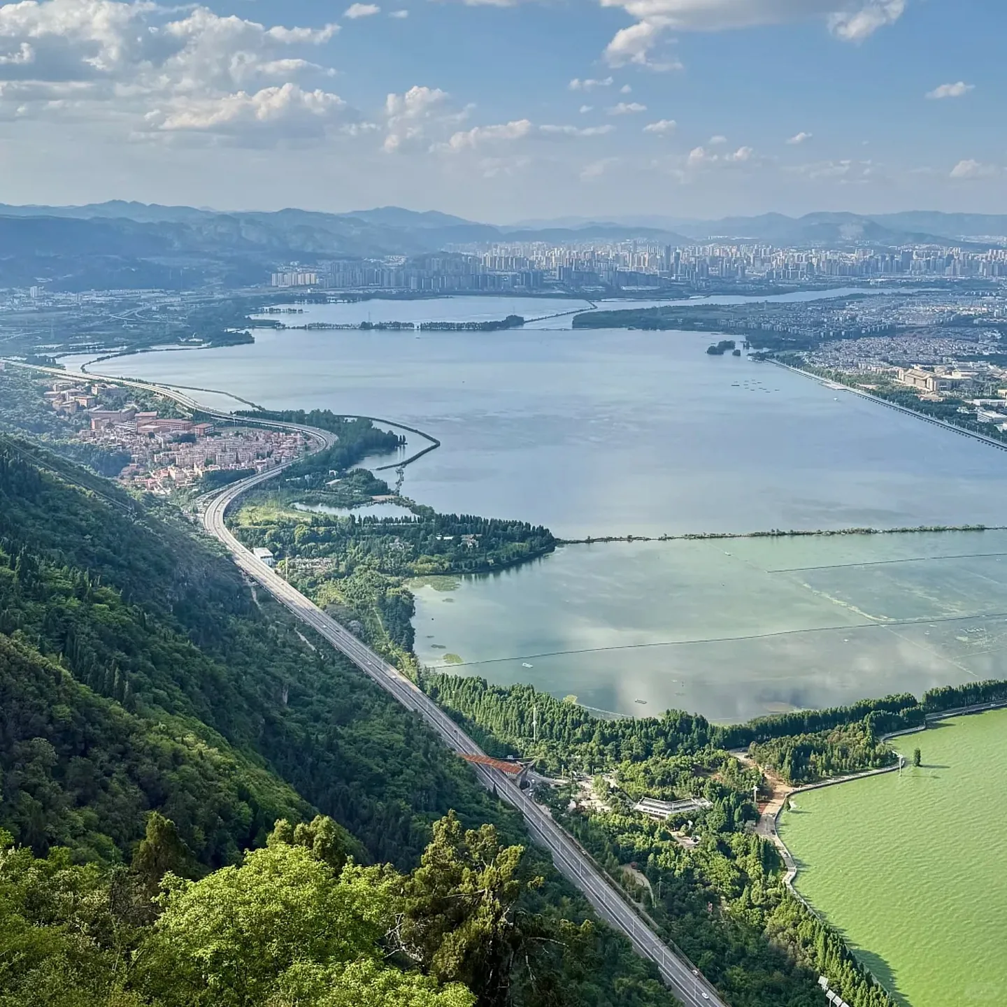
🚶 Walking Short Route (3–5 km, about half a day)
Walk from Haigeng Dam to the Dongfeng Dam seven-arch opening floating bridge; photograph the water bridge and Xishan's reflection, then return the same way in about 2–3 hours.
Note: the floating bridge is pedestrians only — no bikes or e-scooters; free reservation required via the "Zhiyou Spring City" mini-program.
🚴 Full Cycling Route (23 km, 3–4 h)
Rent a bike at Haigeng Dam and ride the lakeside red-blue path straight to Ganjiaowei Sky Mirror, superb at sunset. Ganjiaowei's mirror-flat water is a popular Japanese-style photo spot on Xiaohongshu.
2 · East Shore Wetland Gallery
32 kmThe seven bridges' start, a cluster of viral bridges · photography heaven
🚶 Recommended Walking Segments (6–10 km each)
Line A: Baofeng → Wangguan → Dounan — wetland flower path, birdwatching, shallow-water play, family-friendly
Line B: Jiangwei Village → Water Bridge → Wolong old fishing village — ancient village + rainbow bridge, great in hanfu
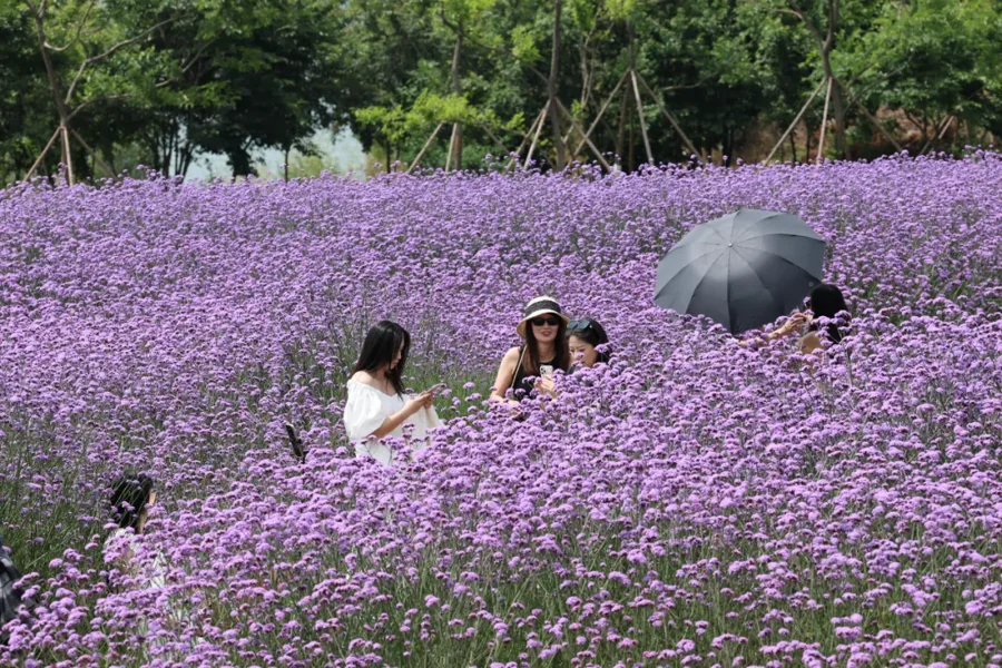
Line C: Laoyu River → Wood Bridge — waterforest boardwalk, summer lotus, July lavender sea of flowers
🚴 Cycling Highlights (15 km, about 3 h)
Dounan Wetland → Water Bridge → Grass Bridge → Wood Bridge → Laoyu River. About 90% of lake-loop check-in posts on Xiaohongshu follow this line; done in 3 easy hours, all shaded metasequoia, flat with no climbs.
3 · South Shore Sunset Scenic
26 kmNo.1 for sunset · gentle slopes, unobstructed views
🚶 Walking Short Route (7 km, sunset special)
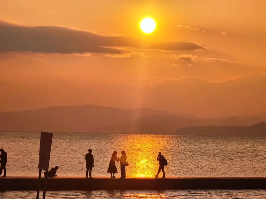
Walk from Haiyan Village to the Hill Bridge viewpoint; leave at 16:30 to catch the 18:30 dusk lake sunset. Claim your spot early — after 17:00 in sunset season it's packed.
🚴 Full Cycling Route (20 km, about 4 h)
Haiyan Village → Hill Bridge → Field Bridge → Village Bridge → Lake Bridge. Pastoral lake views throughout, quiet and uncrowded — ideal for a slow couples' ride.
📌 Detour: Yangzonghai lakeside resort (Shijiazui wetland water play + OCT camping + Balian Hot Springs) — worth an extra night.
4 · Jinning West Section
27 kmAdvanced cycling · not recommended for walking
Mostly mixed-surface county roads, with more heavy trucks and rolling climbs. Only for seasoned cyclists; ordinary visitors should skip this section. No proper walking boardwalk, and few supply points along the way.
⚠️ Beginners, stop at the South Shore section. Jinning suits cyclists with long-haul experience who carry their own supplies.
Along Dianchi Lake, Seven Bridges Unfold
Seven Themed Bridges · One Scene Each
Seven bridges unfold along the lake, each carrying its own spirit of mountain and water. Hill, water, wood, field, lake, grass, and village are set in turn — each bridge its own world, each with its own character.
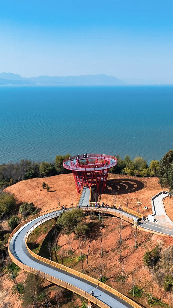
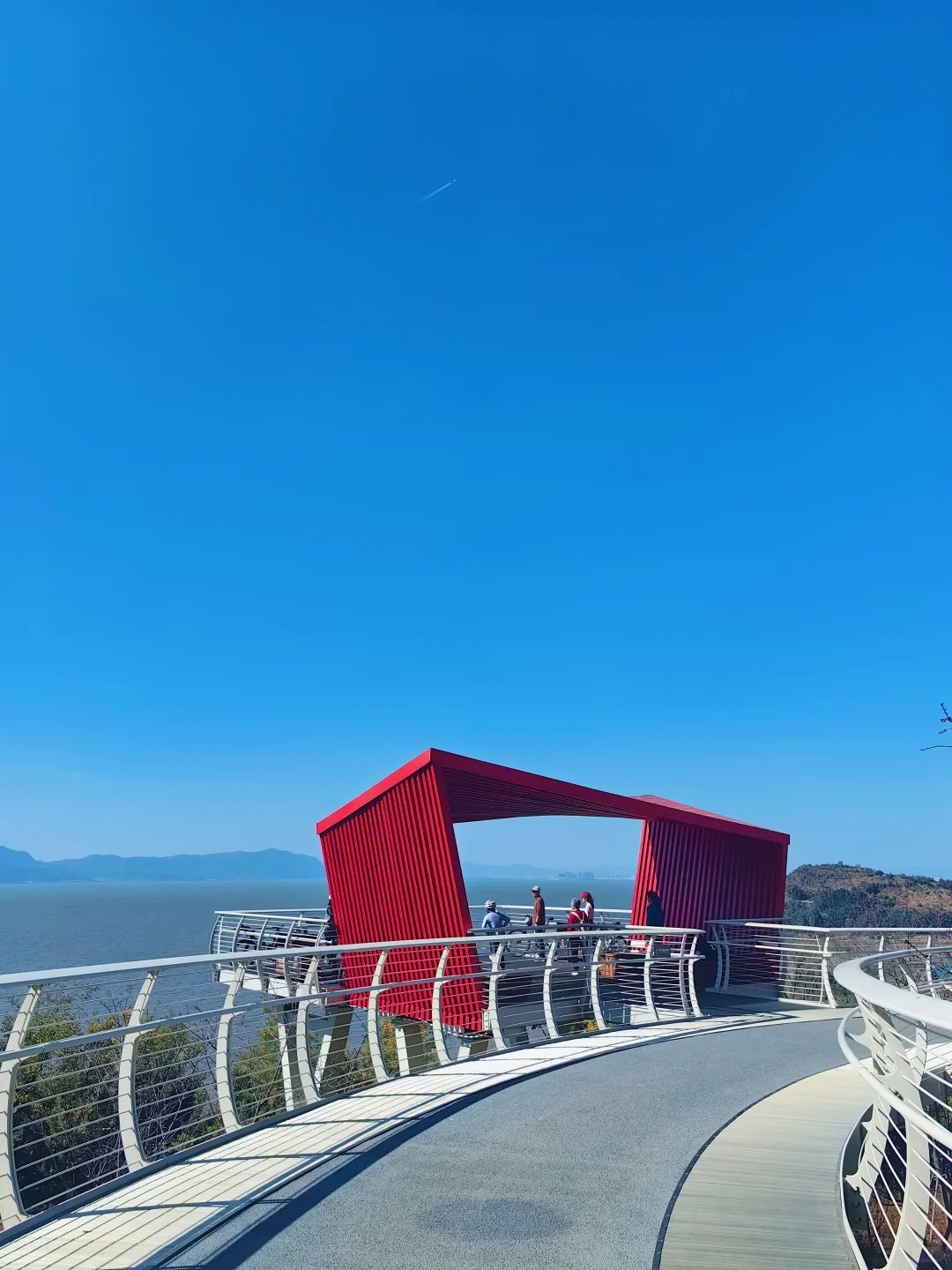
Hill Bridge Hill Bridge
Elevated Trail, Wind and Stamina
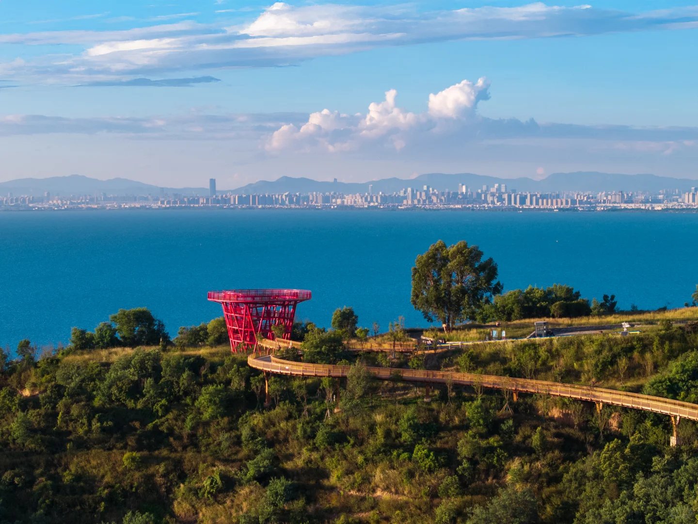
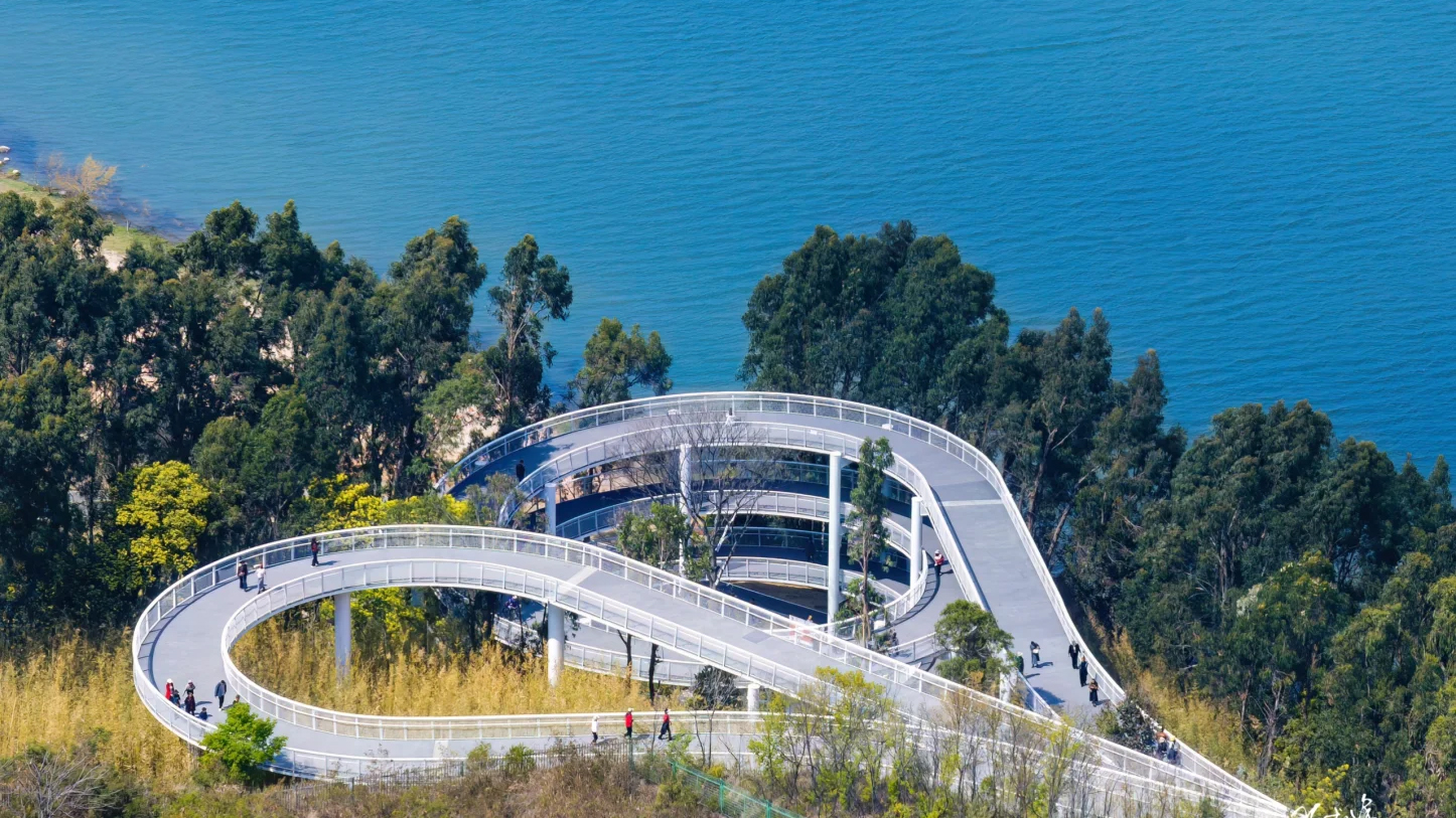
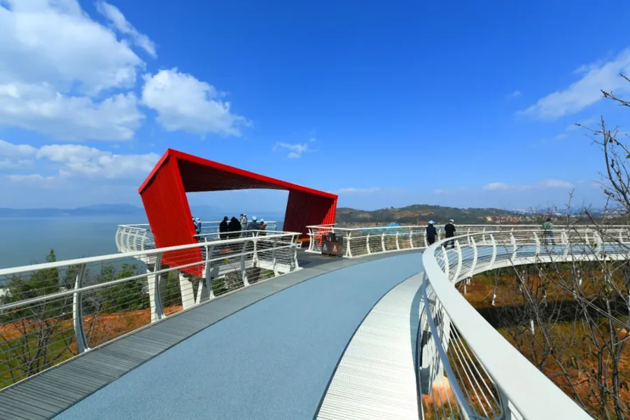
From Haiyan Village the Hill Bridge boardwalk winds more than three kilometers to Changyao Mountain, spiraling up the hillside. The easy looseness of a lakeside stroll turns here into the thrill of a wild-ride climb. A stroke of vermilion between green hills and blue water, you stand on the frame viewpoint with the vista soaring open; the perfect-sunset Haiyan Village is right at hand.
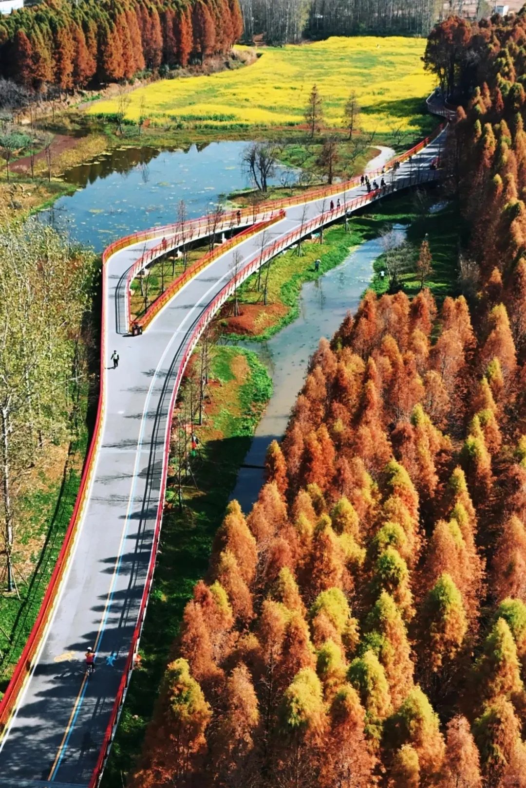
Water Bridge Water Bridge
Golden Shore, Wings Afloat
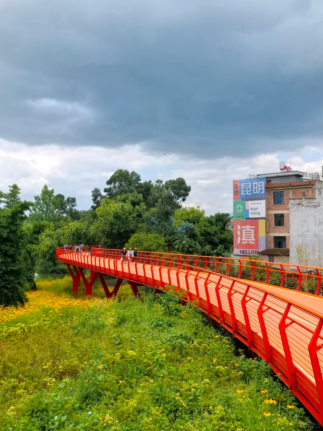
The boardwalk eases out from Jiangwei Village's metasequoia grove, a pale rainbow lying low across the wetland. The shores of Wolong old fishing village host flocks of black-headed gulls; from afar a tree of "fresh snow" on the water — a line of nature's poetry improvised by the birds.
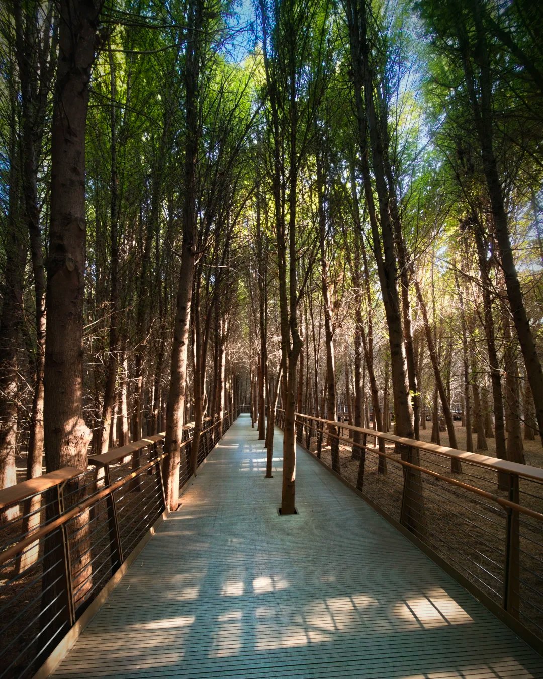
Wood Bridge Wood Bridge
Amber Light Through Woods
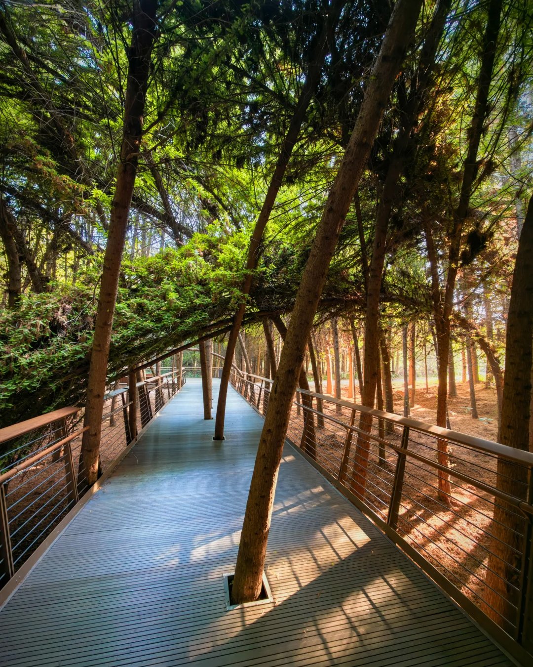
The metasequoia still hold their winter leaves, fallen wood padding the soft trail, light beams dripping through the branches, hazy as a dream. This is the quietest, most inward of the bridges by Dianchi.
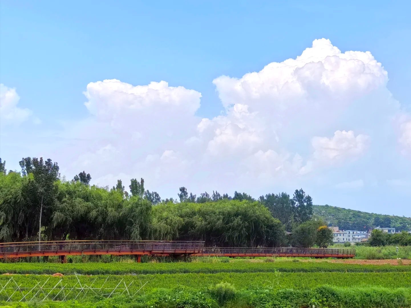
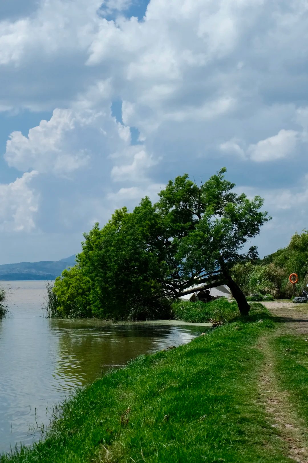
Field Bridge Field Bridge
Passing low and hidden through the farmland wetland — wetland near, rice paddies in the middle distance, village homes far off — a slow flow of homesickness.
- Best for cycling silhouettes when the rice waves in the wind
- Buy fresh-roasted corn at Hepo Village on the way
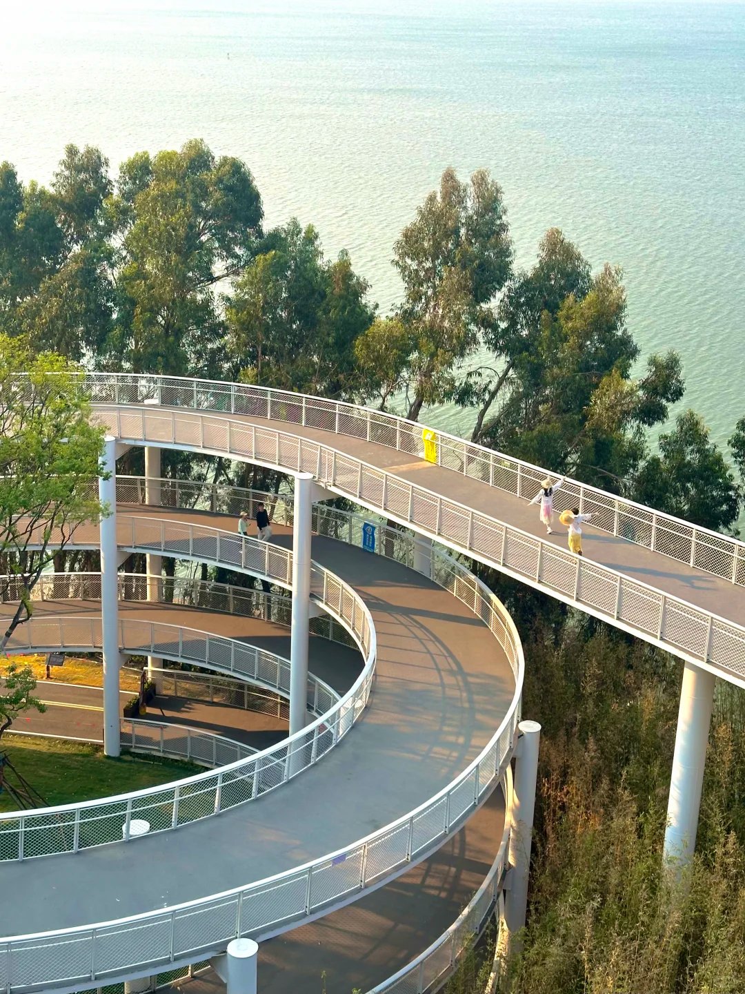
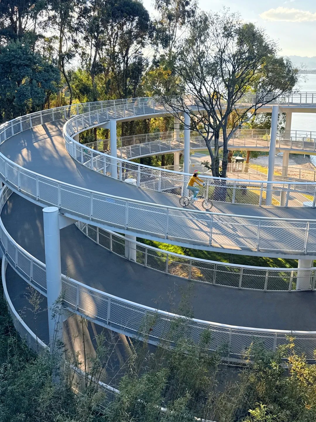
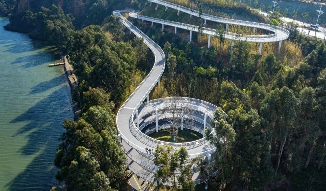
Lake Bridge Lake Bridge
Wander Till Water Turns Soft Blue
The lake lies wide and far, blue gum trees ringing the white boardwalk like fine bone-veins winding downward. Here Dianchi at last lives out the vast, free poetry of the sea.
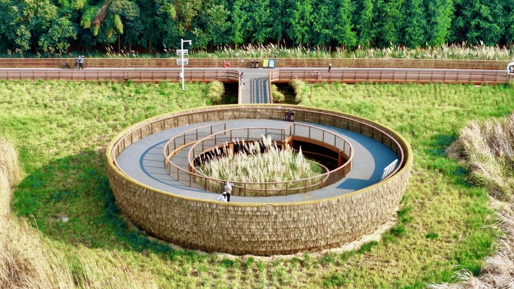
Grass Bridge Grass Bridge
Vast Wetlands, Tides of Blossom
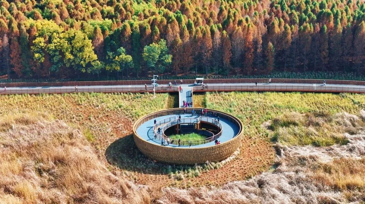
A giant bird's-nest-shaped birdwatching pavilion stands at the center, vast reeds on one side, deep forest on the other. Between the bridge and Laoyu River Park hides a lavender estate, its translucent misty purple layered on.
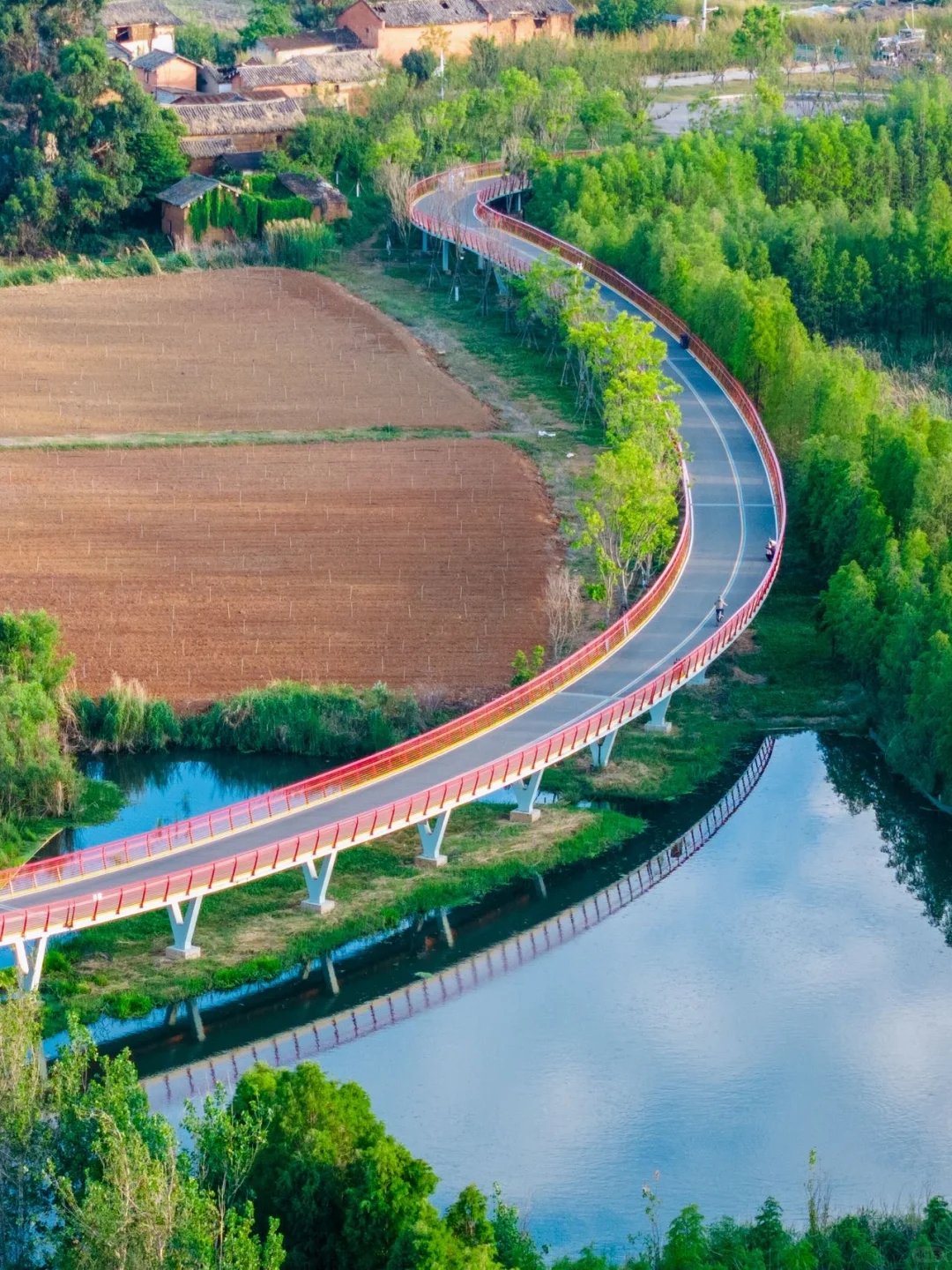
Village Bridge Village Bridge
Linking Niulian Village and Dawan Mountain, a blue gum on the bridge is regarded as a "love tree," attracting red-billed blue magpies.
- Folk murals and display panels set by the bridge
- Niulian fishing village — an ancient hamlet over 500 years old
Public Transit
Every greenway zone is linked by metro or bus; we recommend reaching the entrance by public transit first, then starting your ride or walk.
🚇 Metro to the Entrances
| Line | Station | Entrance | Walk |
|---|---|---|---|
| Line 5 | Daba Stn | Caohai floating-bridge east entrance | 800 m / 10 min |
| Line 5 | Baofeng Stn Exit B1 | Baofeng Wetland Park (East Shore start) | 600 m |
| Line 4 | Gucheng Stn Exit B | Jiangwei Village / Wolong old fishing village | 1 km (shuttle available) |
| Line 1 | Dounan Stn Exit D | Dounan Wetland / Laoyu River shuttle | 2-yuan direct shuttle |
🚌 Official Greenway Tour Lines
Guan 2 Line · Dianchi Lake Loop (recommended)
From/to: Haigeng Dam depot ↔ Ancient Dian Crowne Plaza
Service: 9:00–16:00, rolling departures | Fare: ¥5/person, unlimited rides same day
Via: Haigeng Dam → Haigeng Park → Baofeng Wetland → Wangguan Wetland → Dounan Wetland → Wolong old fishing village → Laoyu River → Haiyan Village → Ancient Dian Wetland
Dianchi Greenway Scheduled Line (popular weekends)
Departures: Haigeng Dam 9/11/13/15; Haiyan Village 11/13/15/17
Fare: ¥10/person, unlimited transfers same day
Best for: hitting all seven bridges in a day, sunset round-trip
Wetland Shuttle Short Lines (¥2 convenience)
• University Town South metro Exit D ↔ Dounan Wetland Park (8:00–18:00)
• Daba metro stn ↔ floating-bridge east (holiday line)
• Guandu ancient town ↔ Baofeng Wetland (Guan 4 Line, ¥3)
🚌 Regular Buses
Caohai: bus 91 / 199 to Caohai Tunnel East; 183 / 233 to Haigeng Dam
East Shore (Chenggong): 265 to Laoyu River Wetland Park; K31 to Ancient Dian / Haiyan Village
Cycling Guide
💰 Rental Prices
Official rental points allow returning at a different location. Locations: Haigeng Dam / Baofeng / Dounan / Laoyu River / Haiyan Village / Water Bridge station.
⚠️ Cycling Rules (must read)
Lane Limits
Red-blue paths are for pedestrians + rental bikes only; shared e/scooters must use the outer service road
Bridges Off-limits
Floating bridges and the seven themed bridges bar e-scooters; walk them across
Clearing Time
Off the main greenway by 19:00; closed at night, unlit
Difficulty
East Shore flat, good for beginners; South Shore's Hill Bridge has a gentle grade; Jinning not for beginners
🛵 Segment E-bikes (if you'd rather not ride the whole way)
Baofeng–Dounan ¥18/person | Wolong–Lavender Estate ¥15/person | South Shore Village–Lake Bridge ¥10/person
Hail to stop
Walking-Only Plans
You can enjoy the greenway without a bike — these three walking routes are designed by duration and theme: light, no gear needed.
Plan A · Caohai Culture Half-Day
Transit: Metro Line 5, Daba Stn
Route: opening floating bridge → Dongfeng Dam wetland → Ganjiaowei Sky Mirror, return same way
Highlights: lake views + Xishan reflection + floating-bridge experience, all flat
Plan B · East Shore Viral-Bridge Day Walk
Transit: Metro Line 5, Baofeng Stn → walk to Baofeng Wetland
Route: Baofeng → Wangguan → Dounan → Jiangwei Village → Water Bridge (rainbow bridge)
Highlights: hundred-mu lotus pond + rainbow bridge + wetland flower sea, taxi back at dusk
Plan C · South Shore Sunset Short Walk
Transit: Guan 2 Line direct to Haiyan Village
Route: Haiyan Village old lanes → Hill Bridge "Eye of Dianchi" viewpoint
Tip: leave at 16:30, catch the 18:30 sunset — highest photo rate
Pitfalls & Practical Tips
⏰ Timing Pitfall
Midsummer 13:00–15:00 is brutally sunny — go before 9 or after 15. In sunset season Haiyan Village / Hill Bridge pack out after 17:00; claim your photo spot early.
🎒 Gear Tips
Lake wind is strong — bring a light jacket. Soft-soled shoes for walking; boardwalk planks are slippery. Carry your own water; convenience stores cluster at Haiyan Village / Laoyu River, with little supply in the middle stretch.
🅿️ Parking & Driving
All 14 main entrances have free/low-cost parking (Haigeng Dam / Baofeng / Dounan / Wolong / Laoyu River / Haiyan Village, etc.). After 10 on weekends spots are tight — prefer public transit.
🚫 No-Go Lines
Large dogs / skateboards / balance scooters / motorcycles are banned from the main greenway path. Floating bridges allow only small strollers; e-scooters are flatly forbidden. Violators may be asked to leave or fined.
🌸 Seasonal Highlights
Jul–Aug: Laoyu River lotus + lavender estate flower sea | Sep–Nov: Water Bridge metasequoia turn red | Year-round: Haiyan Village's reliably stunning sunset
Quick Reference
Suggested Time
Half-day–1 day (mix zones); add Yangzonghai, plan 2 days 1 night
Best Time
Dawn to dusk both fine; Haiyan Village sunset, leave at 16:30
Food
Wolong old fishing village coffee + pea-flour snack; Haiyan Village fishing-village feast
Gear
Sun protection essential; light jacket; soft-soled shoes; camera rewards you
A Full Day's Itinerary
The popular pick, mixing bus + walking + cycling, covering East Shore highlights + South Shore sunset.
Morning · East Shore Wetland Start
Get off at Metro Line 5 Baofeng Stn, explore Baofeng Wetland. Rent a bike and ride the East Shore greenway.
Noon · Old Fishing Village Lunch
Ride to Wolong old fishing village, rest at a café, local pea-flour light meal.
Afternoon · Seven Bridges Check-in
Hit the Water Bridge (rainbow bridge) → Grass Bridge (bird-nest birdwatching deck) → Wood Bridge (metasequoia tunnel), passing Laoyu River's metasequoia grove.
Evening · Chase the Sunset
Ride to Haiyan Village, walk up to the Hill Bridge viewpoint for sunset (arrive by 16:30 to claim a spot).
Return · Lake-Loop Line
Guan 2 Lake-Loop Line straight to Haigeng Dam, transfer to metro back to town.